 |
|
|
|
|
|
|
|
Red Lake County has a rich and varied history in which
the Red Lake and Clearwater Rivers have played a central
role. These rivers provided the proper habitat for a wide
range of wildlife. Over two hundred years ago this wildlife
attracted the Chippewa (Ojibway) Indians who were following
the fur trade business west from the great lakes region. By
1798 Jean Baptiste Cadotte had established a trading post
near the junction of the two rivers in or near the present
day Sportsman's Park in Red Lake Falls.
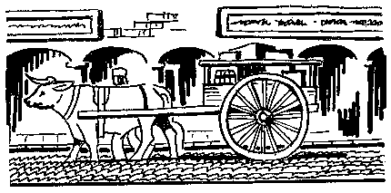
As oxcarts began crossing the area while transporting goods between St. Paul, Minnesota to the south, and the Selkirk or Red River Colony (present day Winnipeg, Manitoba, Canada) to the north, the "Old Crossing" of the Red Lake River near Huot, Minnesota, became a place of historical importance.
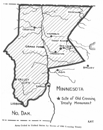
At this site in 1863 a peace treaty was signed between the Red Lake and Pembina bands of the Chippewa Indians, and the U.S. Government. This treaty ceded to the United States nearly 11 million acres of some of the most fertile land in the world.
In 1876 Pierre Bottineau, the famous Metis (of mixed French and American Indian blood) guide, brought the first settlers to the area, 119 families of French Canadian descent who founded the towns of Red Lake Falls and Gentilly. Settlers of European descent followed, attracted to the same waters that attracted the Indians and trappers before them. Newspapers of the time advertised the abundant supply of water power provided by the two rivers.
These same waters still maintain their powers of attraction as vacationers come each summer to enjoy the beautiful scenery while floating in inner tubes on the Red Lake River .
As more settlers arrived many towns were established to serve the farmers or to make use of the county's water power. Few of these still survive today. Only those established along the railroad routes saw the dawn of the twenty-first century.
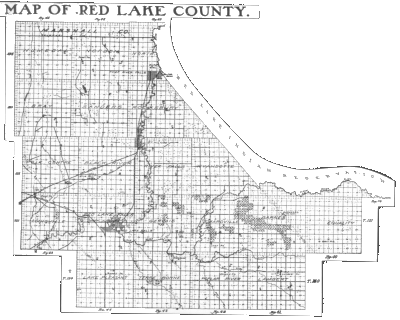
This self tour is divided into two parts Western Red Lake County and Eastern Red Lake County. Each part will take two to four hours and will cover approximately 40 miles designed to introduce you to the diverse and interesting history of the area. Relax and enjoy the beauty of the area as you journey into the past.
|
WESTERN RED LAKE COUNTY XXXX I am working on a new map
|
TOUR STOPS : EASTERN RED LAKE COUNTY XXXX I am working on a new map
|

INTRODUCTIONXXXX need a brief history of Red Lake Falls XXXX
Also see: The Pioneer Days of Red Lake Falls
Red Lake Falls was named after the rapids and falls within the city on both the Red Lake and Clearwater rivers (Also see: placenames.htm). A good place to view the Clearwater river and Main Street is along 7th St. NE. Go three block north on county 13 from highway 32. turn left on 7th St. NE continue until you get a view to the south (left). The view is better in the late fall, winter, or early spring after the trees drop their leaves.
THEN (1918):

NOW: (2001):
XXXX need a picture XXXX
CADOTTE TRADING POST SITE
DlRECTI0NS:
From the scenic view stop return to highway 32 and turn right going down the hill over the Clearwater River. Continue on highway 32 as it turns sharply to the left ant the bottom of the hill. Turn west (right) on Bottineau Avenue, go one mile then turn left into the Sportsman's Park.
From the courthouse go back to Highway 32, turn north (left) and go one block to Bottineau Avenue. Turn west (left), go one mile then turn left into the Sportsman's Park.
The first trading post in the area was erected near this site, at the junction of the Red Lake and Clearwater Rivers, by Jean Baptist Cadotte Jr., an employee of the Northwest Fur Trading Company. (The actual site is unknown but believed to be across the Clearwater river from The Al Buse Sportsman's Park.) We know that Cadotte spent the winter of 1797-98 here from the writings of David Thompson, a geographer and surveyor who took shelter in the cabin during a spring snow storm (1798). Thompson wrote: "Mr. Baptiste Cadotte was about thirty-five years of age. He was the son of a French gentleman by a native woman, and married to a very handsome native woman, also the daughter of a Frenchman. He has been well educated in Lower Canada and spoke fluently his native language with Latin, French and English". Codotte Jr. is given credit for completely opening to the fur traders the region north of the upper Mississippi.
For more information see: codotte.htm
This junction of the Red Lake and Clearwater rivers is also significant in Native American legend. For more see: oldchief.htm
[top]
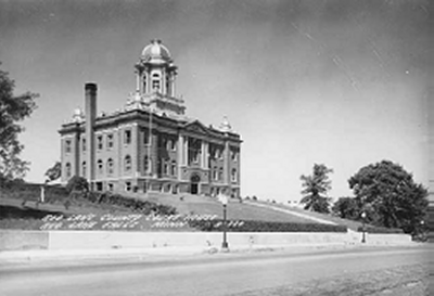
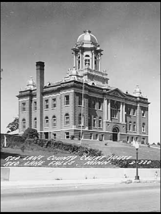
RED LAKE COUNTY COURTHOUSEThe battle to form Red Lake County followed by the fight to name Red Lake Falls rather than Thief River Falls as the county seat, provides an insightful look into pioneer politics in Minnesota. Red Lake County was carved from Polk County in 1896. This courthouse, which originally was topped with a large central dome, was built in 1910 just as Thief River Falls was successfully fighting to form its own county (Pennington).
DIRECTIONS:
From the Codotte Trading Post stop return to highway 32 and turn south (right). You will see the courthouse on the hill to your right. Go past the courthouse and turn west (right) on First Street then right (north) just before St. Joseph's Catholic Church
The building once had a large central dome that was removed in 1947 because it had taken a tremendous beating from the elements resulting in serious leakage.
The courthouse is significant for its central role in the affairs of Red Lake County and for its distinctive style and location. Its hilltop setting and its good integrity make it the most imposing building in the county. It was for these reasons that the courthouse was entered into the National Register of Historic Places in May, 1983. Please walk in and take a look around (enter from the east). A replica of the Statue of Liberty, once housed in the Courthouse dome, is now on display in the rotunda. The building is open during normal office hours, Monday through Friday.
For more information see supplement: courthouse.htm or article by Charles Boughton at http://nmin.ardc.org/history/rlsep.asp
[top]
DlRECTIONS: From Red Lake Falls take Highway 32
south out of town. The Perrault School is on the west
(right) side of Highway 32, four miles south of Red
Lake Falls.
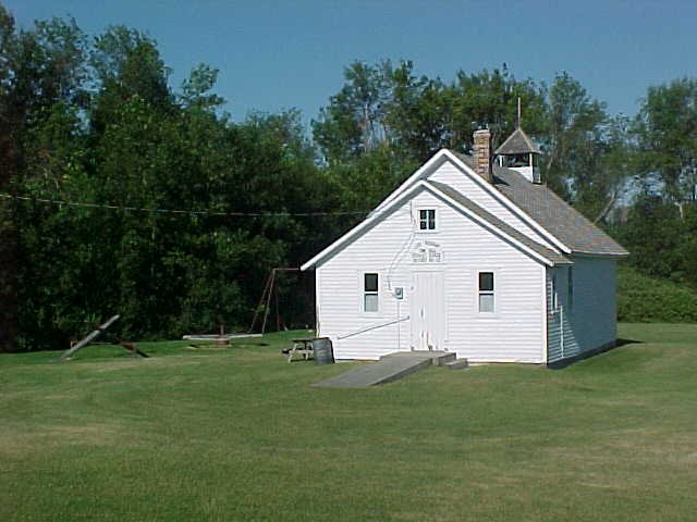
The Perrault School, District #32, was one of six in Lake Pleasant township of Red Lake County. Classes were taught here for 68 years (from 1880 to 1948) when the district was consolidated with that or Red Lake Falls. In 1901 District #32 had Josephine Kaus as a teacher with thirty- one students. Her salary was $30.00 per month. The school building has served as the Lake Pleasant Town Hall since 1881. The school house has been restored as an interpretive center for early American schools.
Please have a look around. The building is locked but you can get a good look through the windows. Local teachers bring their classes to the Perrault School to spend a day "as it used to be".
The Perrault School and the nearby former Perrault Station on the Northern Pacific railroad was named after Charles Perrault, a homestead farmer in the area who died in 1915. Lake Pleasant township was named for a former lake and marsh in its section 18, now drained.
[top]
XXXX AMIOT STORE
For information see RLC History Book
DlRECTIONS: From the Pereault School go north on
highway 32 (back towards Red Lake Falls) and turn west
(left) on county road 33 just before you enter town. Go west
to County road 11 and continue west. Go four miles to where
the road drops down to cross Cyr Creek. Stop before crossing the creek. The Amiot store was to
your left (south) just across the creek. XXXX picture ?
For more information on country stores in Red Lake County see: ghosttowns.htm
[top]
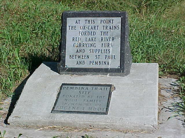
THE "OLD CROSSING" OF THE PEMBINA TRAIL
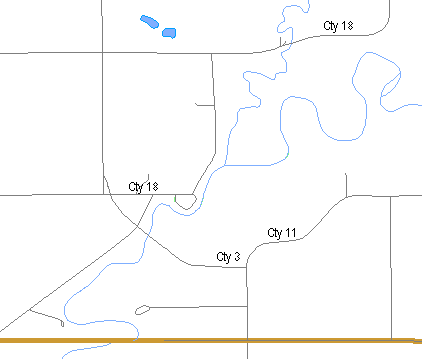
XXXX DIRECTIONS: Continue on to County Road 11 about 2 1/2 miles. Go west (right) on County Road 3. Turn west (left) on County Road 3 and go one half mile. Stop near the bridge over the Red Lake River.
This bridge is located just downstream of the site of the Old Crossing, where from 1844 to the 1870s thousands of ox- drawn two wheel carts crossed the Red Lake River while hauling goods between St. Paul, Minnesota, and the Red River Colony (Winnipeg, Manitoba, Canada). This particular trail became known as the "Woods Trail" because of the forested areas south of present day Detroit Lakes through which it passed, but is known locally as the Pembina Trail. The Woods Trail which passed entirely through lands once controlled by the Chippewa Indians became popular to oxcart drivers when the more westerly trail, along the Red River in North Dakota, came under attack by the Dakota Sioux Indians.
[top]
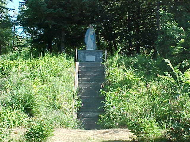
DlRECTIONS: Continue across the bridge and turn north (right) immediately. At the next intersection turn east (right). Look for the shrine on a hill on the north (left) side of the road. Turn right into the Old Crossing Treaty County Park just BEFORE the shrine steps.
This shrine was built by Father Ernest Bossus, pastor of St. Dorothy's Catholic Church from 1926 to 1935. The roots of St. Dorothy's Parish go back to the Huot area, where Father Pierre Champagne offered mass at the home of Louis Huot as early as 1880. At that time there were about 25 Canadian families located in the area. A church, St. Aloysius, was built at Huot in 1883. In 1919 a new church was built in the village of Dorothy (5 miles north) and the St. Aloysius Church was closed. Father Bossus' sight failed in his last years at Dorothy but his eyesight was successfully restored by a cataract operation. In thanksgiving, he built a shrine in honor of the Blessed Virgin on this knoll across the road from Huot State Park. Dorothy's parishioners still gather annually for services at the Shrine.
[top]
Picture: http://www.mnhs.org/places/images/redriver.jpg
DlRECTIONS: The marker is located just inside the Old Crossing Treaty County Park across the road from the Shrine of the Blessed Virgin. (You should already be there.)
This marker is on the site of the Woods (Pembina) Oxcart Trail. If you can brave the mosquitoes, you can see the indentation of the actual trail through the woods ahead of you (see map).
[top]
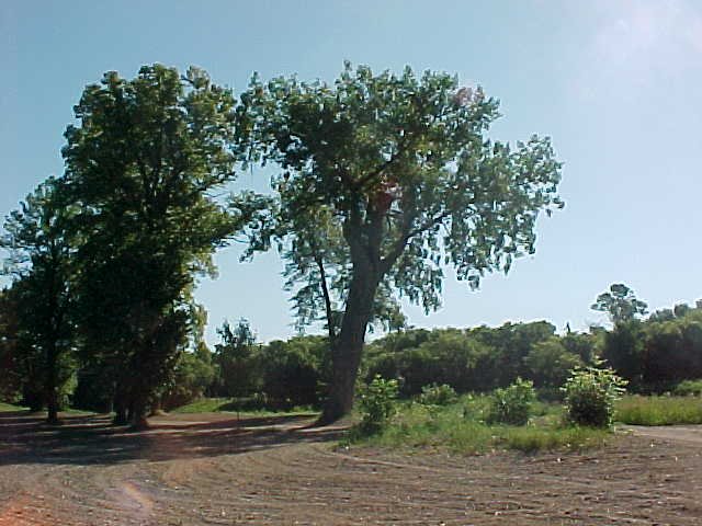
DlRECTI0NS: Continue through the park to the boat ramp on the Red Lake River. Ahead of you is a large Cottonwood tree.
Within the Old Crossing Treaty County Park, along the river just north of the boat ramp, is a large Cottonwood tree which was once used as a post office for early settlers. Oxcart drivers would collect or deposit letters in a box nailed to the tree as they passed through the area. The "Old Crossing" (Stop # 5) of the Red Lake River was near this tree.
[top]
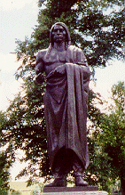
The Old Crossing Treaty memorial, a bronze life-size figure of a Chippewa Indian holding a peace pipe, was erected in 1932 by the U.S. government to commemorate the signing of a peace treaty with the Chippewa Indians in 1863. Representing the U.S. government was Alexander Ramsey, Minnesota's first Territorial Governor, who came from St. Paul escorted by a small detachment of U.S. soldiers. When Ramsey reached the Old Crossing, the Red Lake band of Chippewa were already there with their chiefs Mons-o-Mo, May-dwa-gun-on-ind, Little Rock, Broken Arm, and Leading Feather. Two days later the Pembina band arrived with Red Bear of Pembina and Little Chief of Turtle Mountain as their leaders.
DIRECTIONS: Just before you leave the park is a statue of a Chippewa Indian, on your left.
T. M. McCall writes in Centennial History of Polk County. "To Ramsey's chagrin, Charles Bottineau (a son of Pierre Bottineau), who escorted the Pembina Indians to the conference, had brought not only chiefs and head men as he had been directed, but also almost the whole body of Indians and half-breeds. . . So instead of a small group of leaders assembled on the grounds, they were thronged with more than sixteen hundred Indians and half-breeds."
For more information see: treaty.htm
After two weeks of negotiations the Chippewa ceded an area approximately 180 miles from north to south, and 127 miles from east to west, containing approximately 11,000,000 acres according. For this land the United States paid $510,000.
Article One of the treaty reads as follows: "The peace and friendship now existing between the United States and Red Lake and Pembina bands of the Chippewa Indians shall be perpetual " .
Crossing" of the Red Lake River, where thousands of oxcarts passed, and where the making and signing of the Old Crossing Treaty occurred, is one of the outstanding historical places of Northwestern Minnesota and Northeastern Dakota, and the second day of October, 1863, has become and will remain an outstanding historical date for the states of Minnesota and North Dakota.
For the text of Old Crossing Treaty 1863 see:
http://wwwvms.utexas.edu/~wos/REDLAKE/Cross1.html or
http://www.councilfire.com/treaty/treat321.htm
[top]
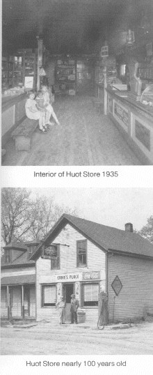
HOUT STORE
DIRECTIONS: As you leave the County Park drive about a
block along the river. HOUT STORE BUILDING NOW (2001): XXXX need a picture XXXX need a short history of Huot - probably is in the
history book. HOUT STORE THEN (1235):
GLACIAL LAKE AGASSIZ SHORELINE
|
DIRECTIONS: Continue going north past the cemetery up the hill to County Road 18 (paved). Turn east (right) and follow County Road 18 east and north. after 4 miles the road will turn right (again). Stop here. |
|
|
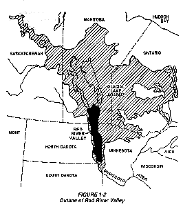
This ridge was once the shoreline of a large body of water known as Lake Agassiz. Over 10,000 years ago glaciers extended as far south as Iowa. As they receded, Lake Agassiz was formed when run off from the melting glaciers was blocked to the north by the glacier. (All rivers in this area drain into the Red River then north to the Hudson Bay. ) Lake Agassiz was huge, extending from well into Canada as far south as present day Breckenridge, Minnesota and east past Upper and Lower Red Lake. Water from this lake drained to the south via Glacial River Warren through whose valley flows the present day Minnesota River. The several successive levels of Lake Agassiz are recorded by distinct and approximately parallel sand ridges indicating the ancient shorelines. Some of these ridges provided excellent natural roadways for the Red River oxcarts. At this point the Pembina Trail (Stops # 5 and 7) crossed the ridge on its way to the Old Crossing of the Red Lake River. Stop your car on the ridge, get out, and try to imagine the glaciers, Lake Agassiz and the oxcart trains which followed them thousands of years later. |
|
For more information see:
[top]
"TUBERS' ATTRACTED TO THE RED LAKE RIVER
|
DlRECTI0NS: Go east one mile to county road 13. Continue east (straight) four more miles on county Road 13. Stop in the road side park to the left just before the bridge over the Red Lake River |
 |
[top]
DlRECTIONS: Continue along County Road 13 to
Highway 32 in Red Lake Falls. Turn left on Highway
32, go one block, then turn right onto County Road
1. Follow County Road one mile to St. Joseph's
cemetery. The Bottineau grave site is near the cemetery
entrance.

|
|
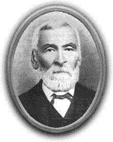
If anyone person stands out in the early history of Red Lake Falls it is Pierre Bottineau. Born in 1817 in Red River country he was the son of a French man and a Chippewa woman. He learned the ways of the woods and prairies while a child trapping with his voyageur father . Fluent in French, English, Chippewa, Cree, Mandan and Winnebago, Bottineau worked for various agencies as interpreter and guide. In 1876 he, and two of his sons, came to what is now Red Lake Falls and staked a claim along the Clearwater river. He encouraged many French Canadians from St. Paul, Minnesota and the Red River Colony (Winnipeg, Manitoba, Canada) areas to settle here. He died in 1895 and was buried in the Cyr Cemetery west of Red Lake Falls. In 1978 his remains, and those of four members of his family, were moved to this site by the Red Lake County Historical Society. |
For more information see: bottineau.htm
[top]
Red Lake Falls was named after the rapids and falls
within the city on both the Red Lake and Clearwater rivers
(Also see: placenames.htm).
A good place to view the Clearwater river and Main
Street is along 7th St. NE ("A" on map at the right). Go
three block north on county 13 from highway 32. Turn left on
7th St. NE. Continue until you get a view to the south
(left). The view is better in the late fall, winter, or
early spring after the trees drop their leaves. XXXX need a brief history of Red Lake Falls XXXX Also see: The Pioneer Days
of Red Lake Falls
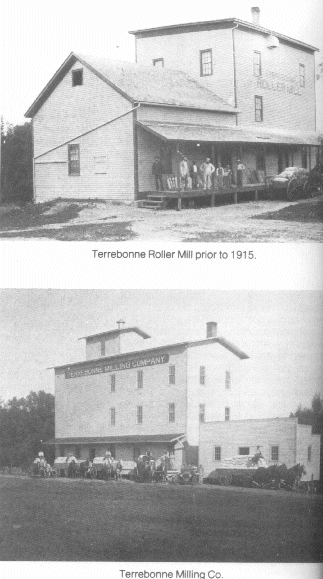
TERREBONNE - Water Power and Mills in Red Lake County
DIRECTIONS: From Red Lake Falls, travel south on highway 32 and go
two miles after leaving the town. Then left on highway 92.
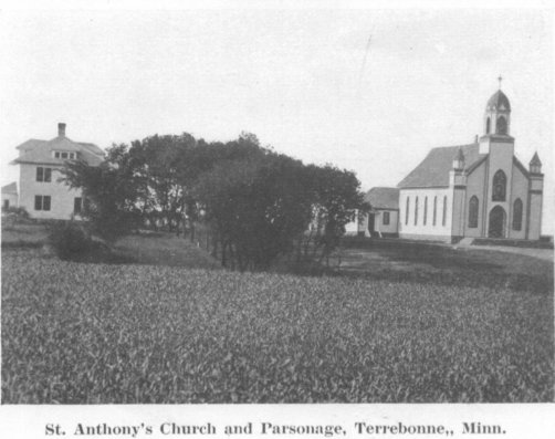
go an additional 6 miles to the Terrebonne church. TERREBONNE CHURCH NOW (2001):
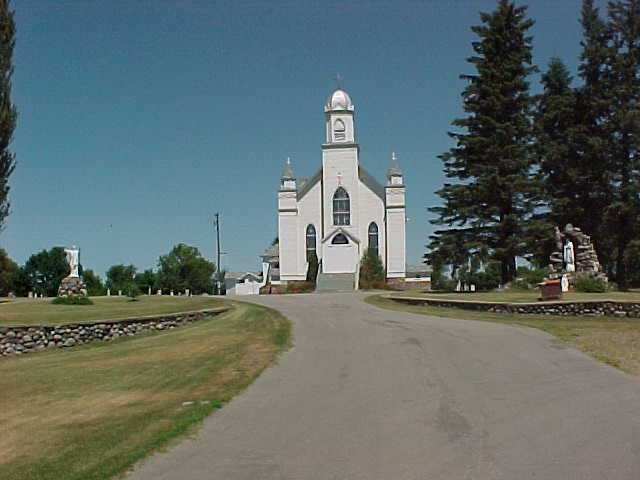
TERREBONNE CHURCH THEN (1919):
|
The following article from the Red Lake County Courier dated December 19, 1901, describes the Terrebonne community at that time and gives an optimistic view of its future. "One of the most progressive and promising inland towns in northern Minnesota is the village of Terrebonne located on the Clearwater river, ten miles southeast of Red Lake Falls. Terrebonne is a French name, and when translated into everyday English, means 'good earth,' and is not a misnomer, for the best land in Red Lake County is tributary to this sprightly village. Some day a railroad will come through, and Terrebonne will become an important center of activity. Its principal industry is its flouring mill which is running continuously night and day, and is turning out a grade of flour Messrs. Kankel & Ziegler, its hustling proprietors, are unable to supply it as fast as called for. Besides the village proper, one half mile south of its location is another small group of buildings among which is a small store and stopping place kept by A. Wolf, and a few residences. The church, which is a very nice appearing building is located at this point, and also the school house. The school has two departments with an enrollment of 85 pupils under the charge of Prof. M. E. Todd, with Mrs. Arthur Laniel as teacher in the primary room . . . . " One mile west of the village is a cheese factory owned and operated during the season by H. Clement.' It is interesting to note that in the 1902 article, the village located along highway 92 was at that time not considered Terrebonne proper. The original Terrebonne, built near the Clearwater River, included the Lajeunesse Hotel, LaPointe Blacksmith Shop, Barrette's Harness Shop, Dupont's Store, the flour mill and a few residences. The highway 92 Terrebonne was also growing. In 1902 Dr. W. O. Tessier, a physician, and O. Tessier, an attorney, built a store and hotel combination near the church, Wilfred Gervais had built a blacksmith shop, and the school District No. 79 was located here. Frank Jeffers was one of the earlier school masters. Professor M. E. Todd and Mrs. Arthur Laniel came a while later. |
|
[top]
DIRECTIONS: From Terrebonne. continue east on highway 92 seven miles to the city of Brooks.
BROOKS THEN:
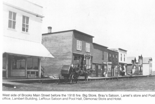
BROOKS TODAY:
XXXX We need a short history of brooks - probably from the
history book
[top]
LAMBERT - Ghost Towns of Red Lake County
DIRECTIONS: From Brooks, return to highway 92 and continue east five miles. At the Lambert Town Hall (on your left) turn right and go about one block to the cemetery on your right.
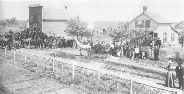
LAMBERT TOWN - THEN:
|
Alfonse F. Lambert and wife, Cesarie, both of Quebec, Canada, came to Lambert Township, Polk County, in 1881 to settle in Sec. 15. Here they built their home in what was to become the Village of Lambert. He assisted in the organization of the new township that bears his name and was a leader in founding St. Francis Xavier Catholic Church. The village grew from the year 1885 with the church, hotel, a blacksmith shop, post office, four stores and several homes. The family of Israel Gibeau and his wife, Elmire, migrated to this country about 1879 from Canada. He was a blacksmith and operated his shop in Lambert Town. Samuel Gibeau, son of Israel, opened a general store and became postmaster. When Red Lake County was formed in 1896, Sam Gibeau was elected first chairman of its Board of County Commissioners. |
|
LAMBERT TOWN HALL
|
The present Lambert Town Hall was built as the first school house in 1882. It is still in its present location, the SE corner of the SW corner of Section 10, located on Hwy. 92. The first teacher was Agnes Monpetit who later married Xavier Bergeron. This building was used as a school until 1904 when a new one was built. |
|
ST. XAVIER CATHOLIC CHURCH CEMETERY

Take a walk through the cemetery noting the inscriptions written in French.
[top]
DIRECTIONS: Go back to State Highway 92 and turn east (right). Go a mile and a half and turn north (left) on sate Highway 222 and go another mile an a half to the City of Brooks. Turn east (right) on First Avenue and go three block to Main Street. Turn left on Main Street. Go one block, turn around, and stop.
TOUR STOPS
- Main Street
- Former home of Coya Knutson - First and Only Congresswoman from Minnesota home: 102 Main St.
- St. Francis Xavier Catholic Church
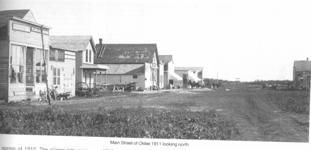
OKLEE
MAIN STREET THEN:
MAIN STREET TODAY (2001):
OKLEE
XXXX We need a picture
When the Soo Line Railroad surveyed a proposed route in 1909/ in preparation for laying the roadbed about two miles northeast of Lambert Town, Oklee was to become the shipping point for freight. The next few years were destined to bring about considerable building as new businesses located near the railroad. The school, stores and homes were moved from Lambert to the new town through about 1917. O.K. Lee had purchased land in 1909 and sold to the Tri-State Land Co. which had the new town site surveyed, platted and named Oklee.
Population of Oklee: 441
Former home of Coya Knutson - First and Only Congresswoman from Minnesota home: 102 Main St.
DIRECTIONS: Congesswoman Knutson's home in here husband's hotel should be on the east side of Main Street, near the railroad tracks. (It should be right across main street from you.)
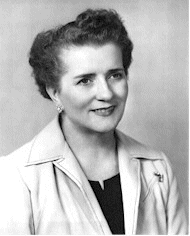
In 1950 Mrs. Coya Knutson, a high school instructor in Oklee and the wife of a local farmer and hotel operator, was elected to the State Legislature where she served the people of the 65th District in Minnesota for three terms.
In 1956 she further distinguished herself and focused the attention of Oklee and the entire country by becoming the first woman from the State of Minnesota to be elected by the people of the 9th District to the Congress of the United States where she served for two terms in the House of Representatives. While there, her ceaseless and tireless efforts in helping to enact the National Defense Education Act, won for her the grateful appreciation of thousands of our young college students and their parents. The Act not only set up a student loan program which provided funds for promising~and needy college students who otherwise might find it impossible to attend school, but also funds to local schools, like Oklee, to help improve the learning and teaching situation.
COYA KNUTSON
|
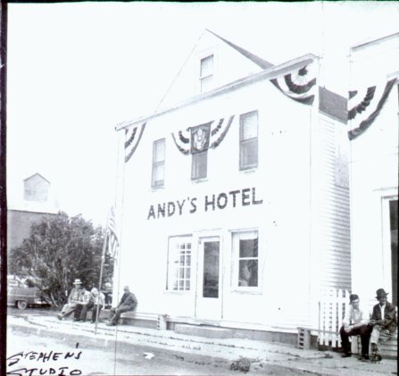
ANDY'S HOTEL THEN (1960):
|
THE BUILDING NOW (2001):
|
[top]OKLEE: St. Francis Xavier Catholic Church
St. Francis Xavier Church was built in Lambert Township under the pastor Father J. Archambault. The structure measured 40 X 90 and the cost was $3,800.
DIRECTIONS: Drive back up Main street and turn west (left) on First Street (the way you came in). Go one block and turn left on Governor Street. The church is one block ahead on the west (right) side of the street.
In 1917 the church was moved to its present site in Oklee. Major improvements were made when Father Charles Trudeau was the pastor from 1929 to 1932. Beautiful stained glass windows were installed at a cost of $75 each. Many
more improvements were made from 1932 until 1952 while Father Keough Patnode served as pastor. A parish kitchen and winter chapel were added, new pews and the pipe organ installed. The new rectory was built in 1958. In 1972 a new addition was built on the front of the church.
Land for the first St. Francis Cemetery, chapel and rectory was donated by Pierre Belland in 1899 in the original location in the Town of Lambert. This cemetery was used until 1915 when land was donated by Joseph Bergeron for the new and present cemetery near the church.
[top]
Clearwater Church - Churches of Red Lake County
DIRECTIONS : Return to State Highway 222 and turn
north (right). The road becomes county Road 5. Go 4 miles
north on #5, and turn east (right) on County Road 1. Go 4
miles east on county Rd #1 and 1 1/2 miles north on county
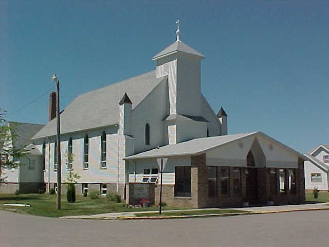
Rd. #10 CLEARWATER CHURCH NOW (2001): CLEARWATER CHURCH THEN: XXXX we need a history of the church
![]()
[top]
![]()
DIRECTIONS: Continue north on County Road 10 to the bridge over the Clearwater River (about 1 mile from the church.
In 1902, the matter of opening more Indian lands north of
the Clearwater River was discussed that would subsequently
enlarge Garnes and Emardville townships to the north. Early
in 1903 a treaty was presented to the Chippewas, but not
ratified by them until February 1904 when certain
stipulations were met, including provision for the removal
of the bodies of dead Indians to a suitable place of
interment. The contract for this removal was let to Jos.
DuChamp for $14.50 per head, the contract calling for the
removal of 113 bodies. Immediately, hundreds of settlers
lined up at the land offices and the gateway to this vast
tract was choked with anxious homesteaders who desired to
gain possession of some choice quarters. In one instance, R.
J. Whipple arose early in the morning and started with a
load of lumber for the claim which he had picked out.
Arriving there shortly after nine o'clock, he found Miss
Tillie LaBree digging a well, claiming the land by right of
occupation. Instances similar to this were common and many
choice quarters were occupied by three and four settlers,
each claiming the priority. The sale of 1904 continued until
late fall when practically all of the tracts had been
taken.
For more information see: landrush.htm
[top]
Roland Country Store - Country Stores of Red Lake County
DIRECTIONS: Just downstream from the County Road 10 bridge. On the north side of the Clearwater River. From the bridge, look west.
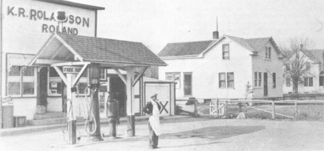
In 1904 when the reservation land opened for settlement north of the Clearwater River, a bridge was built across the river and Otto Dahl erected a store near the bridge on the A. A. Rolandson farm located on the north side of the river. Dahl operated the store for six years and also a post office which was called Roland. He sold the store to the Bondy Brothers in 1912 and they continued in business until 1919 when they sold the sore to A. A. Rolandson and he and his son, Knote, operated the store together for six years. Then Knoute bought the store from his father and in 1939 he sold it to Leonard Singer in 1944. Singer sold the store to Harvey Woods who operated it until 1946 when he in turn sold it to his son, Earl. Earl had the business until 1954 when the store was closed.
Located across from the Roland Store, the Clearwater Creamery was started in 1906 or 1907 by a group of farmers who needed a place where they could take their cream. Among the early butter makers were Carl Rendahl, Gilbert Hoveland, Robert Anderson, and Walter Welte. Raymond Gordon was the last butter maker there and he continued until 1933 when the farmers voted to close the creamery because it was too small.
On this site many years later a dance hall was built by Harvey Woods and named the Silver Star. This hall closed several years later and the building was moved from the site. A boat landing is there at the present time. (pp. 55-56)
Go here for more on the Ghost Towns of Red Lake County.
[top]
|
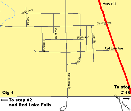
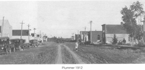
DIRECTIONS: From the Clearwater Bridge at Roland go south on County Road 10 (go back the way you came). Turn west (right) on County Road 1 (also the way you came) and go back to County Road 5. Continue on county Road 1 eight more miles to Highway 59. Turn north on 59 and go just a few blocks to Central Avenue, turn west (left) onto Central Ave. to downtown Plummer. A. Main Street (Central Ave.) |
|
PLUMMER MAIN STREET THEN (1912):
PLUMMER MAIN STREET TODAY (2001):
XXXX we need a picture
XXXX we need a short history of Plummer
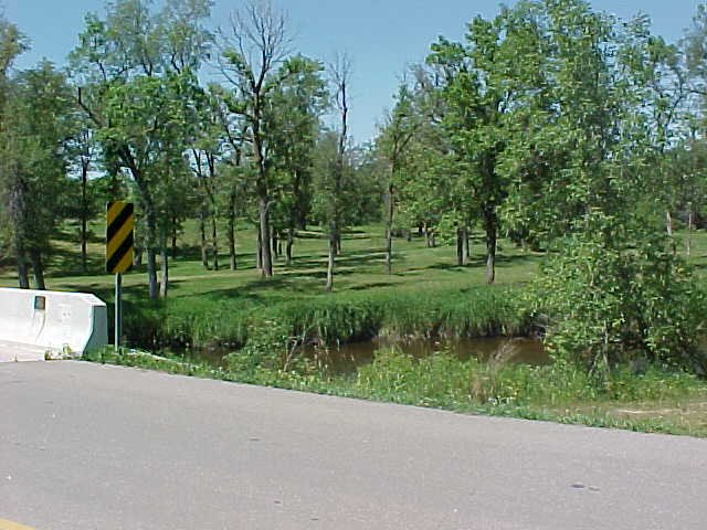
DIRECTIONS: Continue west on central Avenue to the bridge over the Clearwater River
XXXX does anybody know anything about this mill? Was it really located here near the current creamery?
[top]
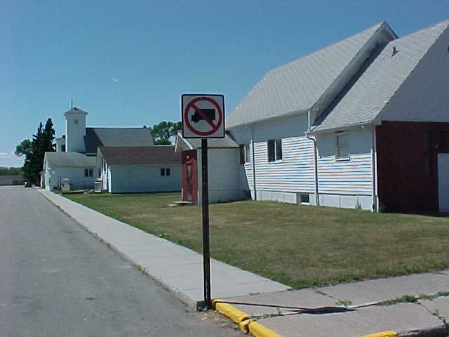
Plummer Creamery
XXXX we need some info. on the creamery from the history book.
Directions: You should be there. It's right behind you.
Plummer - four churches in a row
Directions: From the bridge go back up Central Avenue about three blocks to Maple street. Turn south (right) go one block to Pleth Avenue.
XXXX we need a short write up on the four churches .
DlRECTIONS: From the four churches go east on Pleth Ave to
Minnesota St. Turn south (right), go to County road 1, turn
west (right). Go 12 miles . About a mile before Red lake Falls you
will pass a cemetery entrance on your right as the road
turns to the left. Continue 1/2 mile to the next
cemetery.
|
|
If anyone person stands out in the early history of Red Lake County it is Pierre Bottineau. Born in 1817 in Red River country he was the son of a French man and a Chippewa woman. He learned the ways of the woods and prairies while a child trapping with his voyageur father . Fluent in French, English, Chippewa, Cree, Mandan and Winnebago, Bottineau worked for various agencies as interpreter and guide. In 1876 he, and two of his sons, came to what is now Red Lake Falls and staked a claim along the Clearwater river. He encouraged many French Canadians from St. Paul, Minnesota and the Red River Colony (Winnipeg, Manitoba, Canada) areas to settle here. He died in 1895 and was buried in the Cyr Cemetery west of Red Lake Falls. In 1978 his remains, and those of four members of his family, were moved to this site by the Red Lake County Historical Society. |
[top]