 |
|
|
|
|
For information on the formation of Red Lake County see:
|
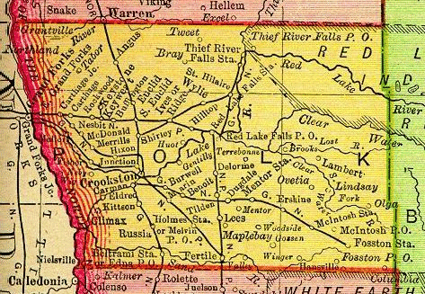
Polk county was formed in 1858. It consisted of what is now all of the present counties of Polk, Norman, Pennington, and Red Lake, over half of Beltrami, and parts of Clay, Becker, and Hubbard counties. Its area was over 7,000 square miles. |
 |
|
|
|
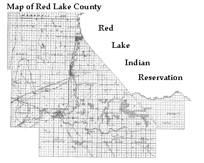
On Christmas Eve, 1896, Red Lake County Minnesota was established through a proclamation signed by Minnesota Governor Clough. The area of the new county consisted of the current counties of Red Lake and Pennington, minus the northeast corner which was then part of the Red Lake Indian Reservation. In February of 1904 when a treaty was signed with the Chippewa (Ojibway) Indians of the Red Lake Reservation which granted to the county the lands north of the Clearwater river in the east. "Immediately, hundreds of settlers lined up at the land offices and the gateway to this vast tract was choked with anxious homesteaders who desired to gain possession of some choice quarters. . . . The sale of 1904 continued until late fall when practically all of the tracts had been taken." |
 |
|
|
|
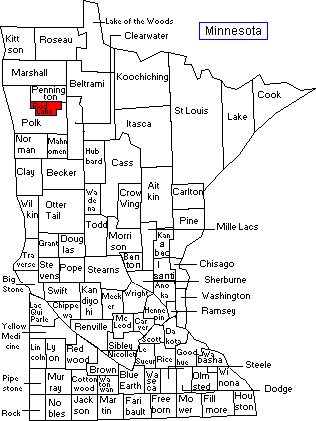
The Red Lake County that we know today was completed in 1911 when Pennington County was formed out of the northern part of Red Lake County. |
 |
|
|